If you would like to request a Spanish interpretation, please email cdphe_apcd_outreach@state.co.us
Si desea solicitar interpretación al español, envíe un mensaje por correo electrónico a cdphe_apcd_outreach@state.co.us
Accessibility statement and support

Friday, August 30, 2024

Here Comes the Smoke

 Smoke has begun to make its way into Colorado this morning. Satellite imagery shows light smoke in northwest Colorado and on the Front Range. Fortunately for Colorado, the heaviest smoke is upwind in Wyoming, Utah, and Idaho.

In northwestern Colorado, particularly Moffat County, light smoke and haze may be noticeable this morning. Smoke is expected to dissipate as atmospheric mixing increases this afternoon.

On the Front Range and eastern Plains, smoke may continue to mix down to the surface throughout the day. The HRRR-Smoke model shows light smoke developing Friday afternoon. In southeast Colorado, there may be noticeable haze and light smoke. 

No major public health impacts are expected, but you may consider taking steps to protect your health from wildfire smoke today. If conditions worsen, CDPHE will issue an Air Quality Health Advisory.

Visible satellite image of Idaho, Utah, Wyoming, and Colorado. Heavy smoke is visible in Idaho, Wyoming, and Utah, while light smoke is visible in Colorado.
Visible satellite imagery shows heavy smoke in Idaho, moderate smoke in Wyoming and Utah, and light smoke in Colorado.

The HRRR-Smoke model shows 2-6 micrograms of smoke at the surface in eastern colorado by 2 pm friday 8/30.
The HRRR-Smoke Model predicts smoke on the eastern Plains this afternoon. As daytime atmospheric mixing increases, smoke could mix down to the surface.


Thursday, August 29, 2024

Potential Smoke on Friday

As of Thursday morning, the anticipated potential smoke hasn't panned out. No major fires broke out in Wyoming yesterday, so Colorado is currently in the clear.

Friday, smoke may return for some of the state. Smoke from the large fires burning in Idaho is expected to move south into Wyoming, Utah, and parts of Colorado beginning overnight Thursday night through Friday morning. Northwestern Colorado may wake up to hazy skies and light smoke. On the Eastern Plains, haze and light smoke are possible as well. 

At this time, no major public health impacts are expected. CDPHE is monitoring the situation and will issue an advisory if necessary. 

Satellite image zoomed in on Idaho, Wyoming, Utah, and Colorado. Heavy smoke, in gray, is visible over most of southern Idaho and parts of western Wyoming.
Heavy smoke is visible in Idaho and western Wyoming. This smoke may move into Colorado overnight Thursday into Friday. 

Wednesday, August 28, 2024

Potential Smoke at the End of This Week

Smoke may be back in the picture this week. While there are still many uncertainties, northern Colorado may experience smoke beginning Thursday.

Red Flag Warning is in effect for much of Wyoming. As of this morning, the fires in Wyoming are mostly contained, but any new fire starts could spread quickly. Northerly winds are expected to develop on Thursday morning, meaning any smoke from these potential fires could reach northern Colorado.

The HRRR-Smoke model indicates that smoke from Idaho could move into northern Colorado by Friday morning. It is still too early to tell with certainty which locations will be most impacted, but CDPHE will continue to monitor and update the smoke blog as this week progresses.


Satellite image of the western US including Washington, Idaho, Montana, Wyoming, and Colorado. Heavy smoke (in gray) is visible in central Idaho, and clouds are visible just northwest of the fires.

Satellite image from Tuesday afternoon shows heavy smoke in central Idaho. Smoke from these fires may make it into Colorado on Friday.

Tuesday, August 27, 2024

Brush fire near Roxborough Park

 A brush fire is burning near the Denver Water treatment plant in Roxborough Park.  There are no immediate air quality health concerns but please avoid the area and we will continue to monitor the situation. 

A map showing the location of the water treatment plant in Roxborough Park near Denver


Thursday, August 22, 2024

Smoke moving into northern Colorado on Thursday from out-of-state fires, 8/22/24

Wildfire activity in Colorado remains relatively quiet, and thankfully smoke impacts from the Goltra fire near Golden are very minimal on Thursday morning. 

However, fires in Wyoming (and other upwind states) remain active, and winds out of the north have drawn smoke into northern Colorado. Monitors on the EPA's fire and smoke map show recent, significant increases in particulate levels in Greeley and the surrounding areas. As these conditions persist during the daytime hours on Thursday, smoke may move into other areas including northern portions of the east plains, as well as along the Front Range, potentially affecting Fort Collins, Longmont, Denver, and areas in-between.

Regional map of fine particulate concentrations shows high levels (red) of particulates in Wyoming, and increased concentrations in areas near Greeley, CO.
EPA's fire and smoke map indicates smoke from upwind states is being drawn into northern portions of Colorado on Thursday August 22, 2024.

As atmospheric mixing increases on Thursday, along with developing rain showers and thunderstorms throughout the region, surface concentrations may decrease throughout the day. Weather models also indicate that winds will shift during the late evening and overnight hours and limit the continued transport of smoke into Colorado. 

For the time being, we expect that the Air Quality Index (AQI) due to fine particulate concentrations will remain in the Good to Moderate range, though short-term increases in smoke levels are possible. We recommend limiting time outdoors and reducing heavy physical exertion if possible in areas affected by smoke, especially for folks who are sensitive to particle pollution. Take precaution to protect you health from smoke exposure in areas where smoke and particulates are present.

We will continue to monitor conditions closely, and will post further updates as information and expectations continue to develop.


Wednesday, August 21, 2024

Goltra Fire burning in Jefferson County

The Goltra Fire is burning in Jefferson County approximately 1 mile west of Golden. The fire is estimated at 200 acres as of Wednesday morning. 

Purple Air sensors downwind of the fire show elevated particulate concentrations this morning. Light smoke and hazy skies are possible in Golden and north Denver throughout Wednesday. Visit CDPHE's website for information on how to protect your health during periods of wildfire smoke

Rain and high relative humidity are expected Wednesday which could aid firefighting efforts, and limit air quality impacts.

CDPHE is monitoring the situation and will issue an Air Quality Health Advisory if necessary.

Map zoomed in on Golden,  Colorado with a fire symbol denoting the location of the Goltra Fire. Yellow squares to the right of the fire show light smoke impacts. South of the fire, green boxes denote good air quality.
EPA's Fire and Smoke Map shows the location of the Goltra Fire, with elevated particulate matter concentrations downwind of the fire.


Tuesday, August 20, 2024

Where's the smoke?

After a very smoky July, August has been relatively clear. There are two reasons for the clear skies and clean air this week.

First, the local fires are under control- the Alexander Mountain and Bucktail Fires are fully contained.

Second, upper-level winds are steering smoke east of Colorado. A ridge of high pressure is situated over the western United States, so when smoke from the large wildfires in Oregon, Washington, Idaho, Montana, and Canada lofts into the atmosphere, it rides the ridge up and around Colorado, and into the Midwest. While our neighbors to the north and east are experiencing smoke, Colorado can finally breathe a sigh of relief.

Of course, the situation can change quickly if new fires spark. Stay tuned for updates.

An upper-level ridge is situated over Colorado. Image courtesy of NOAA's Storm Prediction Center.

EPA's Fire and Smoke Map shows smoke over much of the Midwest, but Colorado is in the clear.

Thursday, August 15, 2024

Potential Smoke Arriving Thursday and Friday

While fire activity has died down in Colorado, smoke still lingers upwind. Several fires are burning in the Pacific Northwest, California, and Canada, and heavy smoke lingers throughout the region. 

A map of the northwestern US and Canada shows fires burning in California, Oregon, Idaho, Washington, and Canada, with air quality monitors (yellow, orange, and red) indicating that smoke is impacting air quality. Monitors in Colorado are green and yellow, indicating that air quality has not degraded from smoke.
EPA's Fire and Smoke Map shows heavy smoke over the Pacific Northwest and Canada.


Smoke may move into Northeastern Colorado beginning Thursday afternoon. Residents in Logan, Phillips, Sedgwick, and northern Weld Counties may notice hazy skies and a minimal uptick in Particulate Matter. Throughout the day on Thursday, smoke may push further south, advancing into Morgan, Washington, and Yuma Counties. 

Overnight Thursday into Friday, more widespread smoke is possible. The HRRR-Smoke model shows light smoke spanning from Fort Collins to Colorado Springs by Friday morning. There may be a noticeable haze on Friday, but no major public health impacts are expected for the Front Range. Additionally, northeast Colorado could continue to see smoke on Friday, with smoke potentially reaching as far south as the I-70 corridor.


The HRRR-Smoke model over eastern Colorado shows the potential for 6-8 micrograms of Particulate Matter in the northeast corner of Colorado, by Thursday afternoon.

The HRRR smoke model  shows smoke potentially moving into northeast Colorado on Thursday afternoon.


The HRRR- Smoke model shows smoke lingering Thursday afternon, with northeastern Colorado potentially seeing an increase in Particulate Matter.

By Thursday evening,  the HRRR-Smoke modelshows smoke lingering in Northeast Colorado.


The HRRR-Smoke Model on early Friday morning shows potential smoke impacts for the Front Range, and northeaastern Colorado.
Friday morning, the HRRR-Smoke model shows smoke along the Front Range and northeastern Colorado.


Wednesday, August 14, 2024

Out--of-state wildfire smoke possible on Thursday for northeastern Colorado

 There's still plenty of wildfire activity across the northwestern United States, but thankfully the smoke from those fires has largely avoided Colorado for the past several days.  That might be about to change.  Although we are not anticipating heavy smoke at this time, there is certainly the possibility that particle pollution could be elevated on Thursday across the northeastern corner of Colorado, including Julesburg, Ft. Morgan, and Akron.  By Thursday afternoon and evening, some of that smoke may reach the northern Front Range region of Denver, Boulder and Ft. Collins.  Stay tuned.

EPA's Fire and Smoke Map
EPA's Fire and Smoke Map shows numerous wildfires and heavy smoke across the Pacific Northwest on Wednesday morning, 8/14/24

Friday, August 9, 2024

Smoke may be around this weekend, but limited amounts are expected near the surface, 8/9/24

There is a bit of  'a tale of two levels (of the atmosphere)' to be told for the upcoming weekend. Fires in California and the Pacific Northwest continue to be active and produce plenty of smoke, which is likely to be transported eastward. However, much of that smoke is expected to remain aloft, in upper portions of the atmosphere, and is also expected to mostly stay to the northern areas of the western U.S., resulting in minimal surface impacts in Colorado. the images below, from the HRRR-Smoke model show the large plumes of smoke coming from the states to our west and northwest, and also show the great differences in the amounts of smoke that are expected to be found throughout the atmosphere (top) vs amounts expected near the surface (bottom).

Map showing widely ranging concentrations of smoke in the northwestern U.S., with higher amounts found in Idaho, Montana, Washington and Oregon, over those generally found in Colorado, Wyoming, and Nevada.
HRRR-Smoke vertically integrated smoke at 00Z, Sunday, August 10, 2024 (6pm MDT, Saturday).
Map showing widely ranging concentrations of smoke in the northwestern U.S., with pocketed areas of higher amounts found in Idaho, Montana, Washington and Oregon, over those generally found in Colorado, Wyoming, and Nevada.
HRRR-Smoke near-surface smoke at 00Z, Sunday, August 10, 2024 (6pm MDT, Saturday).

The Big Gulch fire in Moffat County and the Bucktail fire in Montrose County continue to only report limited containment and increases in size. However, only limited and transient heat signatures have been seen on satellite (and these may have come from burning operations conducted by fire crews in efforts to strengthen fire lines) and PM2.5 monitors in these areas continue to show only light to moderate concentrations of smoke. Due to these observations, no advisories are currently in effect for these fires.

In all, only light to moderate amounts of smoke are expected for the weekend, however with ever-evolving situations such as those involving wildfires, conditions may change quickly. Pockets of smoke may be present in areas in the immediate vicinity of wildfires in Colorado, and we recommend undertaking health precautions if smoke is present in your location.


Thursday, August 8, 2024

Light to Moderate smoke possible in areas of northwestern Colorado on Thursday, 8/8/24

We are glad to be reporting about the air quality impacts due to smoke in Colorado with a far lower sense of alarm than has been seen recently! However we always want to keep everyone alert to all situations that may influence public health, so we continue to monitor fires in Colorado, and those in up-wind states that may produce smoke impacts here.

The Bucktail Fire in Montrose County has remained fairly quiet, not showing significant heat or smoke production, and has allowed advisories and commentary to be unnecessary. We continue to monitor conditions in the area, although information on this fire remains sparse. We will provide updates as needed if things change in this area.

The Big Gulch fire in Moffat County (~15 miles west of Craig) increased in reported size between Wednesday and Thursday, yet this incident also has not shown significant heat or air quality impacts on Thursday. Most of the smoke seen in NW Colorado likely originated from fires that are out-of-state and is being transported into Colorado, however light concentrations of smoke emanating from the Big Gulch fire may be contributing to the yellow color of monitors shown on the fire and smoke map from airnow.gov. This indicates Moderate air quality due to fine particulates in northwestern Colorado.

Map of smoke (particulate) monitors throughout the northwestern U.S. show green to yellow conditions (good to moderate air quality) in Colorado, with orange and red colored stations in Idaho, Oregon, and California, indicating higher concentrations of smoke in these areas upwind of Colorado.
Fire and smoke map showing conditions in Colorado and upwind states on Thursday afternoon.

Models also suggest that some of the smoke seen in areas of Idaho, Utah, Nevada, Oregon, and California may move into Colorado over the next couple of days, however we expect that surface impacts will remain light to moderate. There is some possibility that larger concentrations of smoke may head our way during the coming weekend, but it is a bit too early to put too much confidence in the numbers and locations that may see this influence, so we will continue to watch closely and update information on this page as expectations become more clear.


Wednesday, August 7, 2024

More Smoke Coming for Colorado

Northwestern Colorado could experience another shot of smoke starting tonight.

Smoke models show smoke advancing into northwestern counties as early as Wednesday night, and continuing throughout the day Thursday. Smoke from fires in Canada and the Pacific Northwest could advance into northwestern Colorado, as a cold front moves in from the north. 

Residents in Moffat, Routt, Jackson, and Rio Blanco Counties may wake up to hazy skies and noticeable smoke on Thursday morning. Smoke is expected to stick around throughout the day Thursday, so you may consider reducing your time outdoors if you are in these locations.

This model also shows light smoke moving through eastern Colorado, but widespread rain and thunderstorms are expected on Thursday, which should limit smoke impacts.

Map of western United states showing concentrations of smoke over the region. Northwest Colorado will begin to see smoke increasing by midnight Wednesday night.
The HRRR-Smoke model at Midnight Wednesday night shows smoke beginning to advance into northwestern Colorado.

Map of western United states showing concentrations of smoke over the region. Northwest Colorado is expected to have moderate concentrations of smoke Thursday.
The HRRR-Smoke model shows more widespread smoke by 6 am Thursday.


Tuesday, August 6, 2024

Bucktail Fire Smoke Subsiding

Finally, some good news for Colorado's air!  

The Air Quality Health Advisory for Wildfire Smoke in Montrose County has been allowed to expire Tuesday morning.

Activity on the Bucktail Fire has calmed down, and satellite imagery shows an improvement in smoke this morning. Tuesday afternoon, rain is expected, which could help to limit the fire's growth. There is, however, some uncertainty in how much wind will enhance fire growth this afternoon. As thunderstorms roll through, wetting rain will help to limit fire activity, but gusty winds can contribute to growth.

CDPHE is monitoring this fire and will re-issue an Air Quality Health Advisory if necessary.

Visible satellite imagery of southwestern Colorado, with Montrose County in the Center, shows cloud cover over Colorado, but no smoke near the Bucktail fire.

Satellite imagery shows no smoke near the Bucktail Fire as of Tuesday morning.

Map of Colorado with the perimeter of the Bucktail fire outlined and shaded in Red. Green dots indicate the locations of the nearest monitors to the fire all showing good air quality.

EPA's Fire and Smoke Map shows that all monitors near the Bucktail Fire (outlined in red) are reporting Good air quality as of Tuesday morning.

Monday, August 5, 2024

CDPHE Wildfire Smoke Preparedness Program

CDPHE's Wildfire Smoke Preparedness Program provides outreach, education, and training for local community partners on responding to wildfire smoke and its impacts on community health. For more information or if you are interested in joining our Stakeholder Education and Training Network to receive program updates and information on wildfire preparedness, please visit the Wildfire Smoke Preparedness Program webpage.

Heavy morning smoke in parts of western Montrose County

 The Bucktail Wildfire remains active in western Montrose County with morning satellite imagery  revealing heavy smoke in areas near the fire.  The communities of Nucla and Naturita are most likely to be impacted.  The good news is that we should see gradual improvement through the morning hours and into Monday afternoon as smoke begins to lift from the surface with the heating of the day.  Wet weather this afternoon may also provide benefits, but there is always that threat for gusty winds and lightning strikes which could complicate matters.  So we do ask those residents in the immediate area to remain alert to changing conditions and continue to take steps to protect your health from wildfire smoke.

A satellite image showing smoke in the vicinity of the Bucktail wildfire in western Montrose County


Meanwhile, we continue to see nice improvement in other parts of Colorado.  The large northern Front Range wildfires have eased up quite a bit and are producing far less smoke than they were a few days ago. There are some indications that we may get a moderate smoke intrusion to the northeastern corner of Colorado later this afternoon and into Monday evening, perhaps bringing some elevated fine particulate concentrations to Sterling, Julesburg and Holyoke.  But that remains uncertain at this point and we will continue to monitor the situation throughout the day. 


Sunday, August 4, 2024

Smoke conditions in many areas much improved on Sunday morning, 8/4/24

 Although the Alexander Mountain fire, Stone Canyon fire, and Quarry fire are not considered 'out', containment has increased on all of these incidents, and fire activity and smoke production has decreased significantly. Most importantly for public health impacts, only light to moderate concentrations of smoke were observed all day on Saturday, and again on Sunday morning. For these reasons, the Air Quality Health Advisory for Multiple Pollutants has been allowed to expire at 9 am on Sunday morning.

Fire and smoke map from fire.airnow.gov shows green and yellow (good to moderate) concentrations of smoke throughout the northern Colorado Front Range region
Significant improvement is seen on the fire and smoke map from fire.airnow.gov on Sunday morning, 8/4/24.

Hot and sunny weather is again expected on Sunday, and there is potential for afternoon thunderstorms to move through the fire areas. These conditions create potential for fire activity to increase and elevate concerns for smoke impacts, so we will continue to monitor all fires closely, and will re-issue any air quality alerts if they become necessary. Highly localized areas of smoke remain possible for locations in close proximity to fires, so we encourage everyone to remain aware of changing conditions and take precautions if smoke is encountered in your location, however widespread public heath impacts from smoke are not anticipated at this time along the Front Range.

The Bucktail fire in Montrose County continued to show heat and smoke throughout the day on Saturday, so the Air Quality Health Advisory for Wildfire Smoke will remain in effect for this area until at least 9 am Monday morning.

Saturday, August 3, 2024

Smoke impacts on Saturday, 8/3/24

Smoke from all wildfires in Colorado showed significantly lower impacts on Saturday morning, however this does not meant that concerns for this potential have been eliminated.

Along the northern Colorado Front Range PM2.5 monitors showed mainly Green and yellow (Good and Moderate) levels of fine particulates (smoke) on EPA's fire and smoke map. This is welcome news after several days of more significant smoke throughout the region. 

Map of air quality sensors from fire.airnow.gov shows green and yellow color on nearly all sensors, indicating good to moderate air quality due to fine particulate matter (smoke) along the Colorado Front Range, from Fort Collins to Castle Rock.
Map of air quality sensors from EPA shows good to moderate air quality from Fort Collins to Castle Rock on Saturday morning.

However, hot, dry, and breezy conditions are in store once again on Saturday. This may lead to an increase in fire behavior and smoke production. Winds during daytime hours are expected to move from the east to the west, and may transport much of the smoke from the Alexander Mountain Fire and the Stone Canyon fire westward and away from population centers, however impacts will remain in areas that are in close proximity, downwind of the fires. During overnight and early morning hours, areas that are below these fires' locations may see the greatest impacts as smoke drains toward lower terrain.

Folks along the Front Range, and especially in areas near active fires should remain aware of air quality conditions, and remain vigilant about taking health precautions to reduce negative effects due to air quality.


In southwestern Colorado, the Bucktail fire remains active, and smoke is expected to again affect areas of Montrose County on Saturday and Sunday.

Information about all Air Quality Advisories and Action Days can be found on the CDPHE/APCD website, and will be updated as these situations evolve.

Friday, August 2, 2024

Continued Smoke on Friday

While there have been some reductions in smoke over the last 24 hours, Colorado is not completely in the clear just yet. Smoke from several wildfires burning in the state will continue to impact air quality on Friday.

First off, smoke from the the Stone Canyon Fire and Alexander Mountain Fire will continue to impact the Northern Front Range Region. Locations nearby and downwind of the fires will see the heaviest smoke today. The good news is, the Quarry Fire is putting out less smoke this morning, and particulate concentrations have decreased in the southwest Denver Metro.

Zooming out to the rest of the Front Range, there have been some improvements since yesterday at this time. Moderate smoke still remains throughout the northern Front Range Region, and is expected to remain moderate for the rest of today. However, thunderstorms are expected to develop Friday afternoon, which brings some uncertainty into the equation. On one hand, gusty winds help to scour out some smoke, but on the other, wind can contribute to fire growth and smoke production.

EPA's fire and smoke map shows plumes of smoke over the Northern Front Range Region, with the majority of monitors showing Moderate Particulate Concentrations.
EPA's Fire and Smoke Map shows widespread smoke over the Northern Front Range Region, with localized heavy smoke in locations near the Alexander Mountain Fire.

Next, smoke from the fires burning on the Front Range has moved west into north-central Colorado. Light smoke is present this morning, including Steamboat Springs and Walden. Smoke is expected to dissipate this afternoon as daytime atmospheric mixing picks up, but could increase again this evening, depending on the fire behavior today. For those unusually sensitive to smoke, you may consider reducing your time outdoors today.

Finally, the Bucktail Fire is burning in Montrose County, approximately 5 miles northeast of Nucla. An Air Quality Health Advisory for Wildfire Smoke is in effect for Montrose County, and has been extended until 9 am Saturday. CDPHE is monitoring this fire and will provide updates as necessary.

Large plume of gray smoke in an field with sage brush in the foreground, and hills in the background.

Plume from the Bucktail Fire on Thursday afternoon. Image Courtesy of San Miguel Sheriff's office.

Thursday, August 1, 2024

Late night smoke for Steamboat Springs?

 Widespread wildfire smoke continues to plague the northern Front Range region Thursday afternoon, and likely will be sticking around into Friday as well with the Action Day for Multiple Pollutants set to be extended through at least 4pm Friday.  Residents along the I-25 urban corridor, including Denver, Boulder, Ft. Collins and Greeley, should continue to take those extra steps to protect your health from wildfire smoke by limiting time outdoors, if possible, and while outside taking some extra breaks.  But the pollution is certainly not uniform across the area.  Locations in closer vicinity to the wildfires are seeing much higher particle pollution levels, and hence are receiving more concerning public health impacts.  As of 2:00pm Thursday afternoon (see image below), the heaviest smoke is located in Longmont, Niwot, Boulder and into northwestern parts of the Denver metro area.  These areas will likely continue to be impacted Thursday night and Friday morning, with a distinct possibility that the smoke could locally get even heavier (especially in Longmont) as smoke drains down from the Stone Canyon Fire. Also, please don't let your guard down in Loveland and southwestern parts of the Denver metro area.  Although air quality has improved marginally today as atmospheric mixing increased, smoke could increase again later on tonight as smoke drains from the Alexander Mountain and Quarry wildfires, respectively. 

A map showing widespread elevated particle pollution levels across the northern Front Range, with locally heavier smoke in Longmont and Boulder Thursday afternoon

What about the rest of Colorado?  For the most part, it's not too bad out there Thursday with generally light to moderate levels of particle pollution from some remnant light smoke.  However, there have been some indications with smoke modeling that a plume of smoke from the Front Range fires may get up and over the Continental Divide and settle into north-central Colorado overnight.

Smoke modelling that shows heavy smoke pushing from the fires into north-central Colorado at 11pm Thursday evening
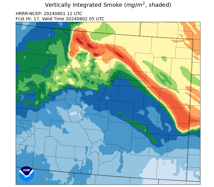
HRRR-smoke model for total column smoke at 11pm Thursday evening

Is this really going to happen?  Hard to say, unfortunately.  Although it looks fairly likely that smoke currently up in the atmosphere over the Front Range fires will push to the northwest towards north-central Colorado overnight, there is less confidence that smoke will be able to mix down to the earth's surface and create public health issues. 

Regardless, it's probably not a bad idea to shut your windows before you go to bed tonight in Walden and Steamboat Springs, and throughout Routt, Jackson and Grand Counties.  We will certainly provide updates as necessary while the situation continues to evolve.

Another smoky day for the northern Front Range

 Although smoke levels have improved for many parts of Colorado Thursday, that is certainly not the case for the big cities of the northern Front Range.  Moderate to heavy smoke can be found up and down the I-25 corridor from Denver northward to the Wyoming stateline.  And embedded in this geographical area are some areas of significantly heavier smoke.  These are the areas that are directly "down drainage" from the wildfires that have plagued the region for the past few days.  In the image below from the EPA's Fire and Smoke Map, you can see much higher levels of particle pollution in and near Loveland and Longmont (and to a lesser degree, southwest Denver).  It's important for residents of these areas to limit their time outdoors this morning, if possible.  We do anticipate some improvement with the air quality as the atmosphere heats up later this afternoon.  Please remember that an Action Day for Multiple Pollutants remains in effect for this area through at least 4pm today due to high levels of both particle pollution from smoke, and ozone which will be on the increase this afternoon.

A map showing elevated levels of particle pollution throughout the northern Front Range, and locally heavier smoke in Loveland and Longmont